Contents
The Earth’s surface is a canvas constantly being painted, sculpted, and reshaped by an intricate dance of forces and processes. From the towering peaks of mountain ranges to the sprawling flatness of river deltas, every landform tells a story of creation, change, and destruction. The discipline dedicated to deciphering these stories is geomorphology. As an informational resource committed to providing clear answers and illustrative examples, Bwexjuv.com delves into this fascinating field, exploring how our planet’s skin is shaped and what its dynamic nature means for our future
Geomorphology: Unveiling Earth’s Dynamic Skin
A. The Core Definition: What is Geomorphology?
At its heart, geomorphology is the scientific study of Earth’s surface features, including their origin, evolution, and the processes that create and modify them. It investigates the landforms themselves – such as valleys, mountains, deserts, coasts, and plains – and seeks to understand how they came to be, what forces are currently acting upon them, and how they might change in the future. It bridges the gap between the solid Earth (geology) and the fluid Earth (atmosphere and hydrosphere), focusing on their dynamic interactions at the surface.
B. Why Study It? The Fundamental Questions:
Geomorphology seeks to answer fundamental questions about our physical world. Why do landscapes look the way they do? Why are some mountains jagged and others rounded? How do rivers carve canyons, and what determines their winding paths? How do coastlines erode or build up over time? Beyond mere curiosity, studying geomorphology is crucial for understanding the natural hazards that affect human populations, managing natural resources sustainably, and predicting the impact of climate change on our environment. It provides insights into the past, informs the present, and helps us anticipate future states of the Earth’s surface, which is directly relevant to human habitation and infrastructure.
C. Scope and Scale:
The scope of geomorphology is remarkably vast, spanning multiple scales. It can involve microscopic analyses of soil particles and their properties, understanding the development of a single sand dune, or examining the large-scale evolution of entire mountain ranges or continental drainage systems. While traditionally focused on terrestrial environments, the principles of geomorphology are increasingly applied to understand landforms on other celestial bodies, a field known as planetary geomorphology. This broad scope highlights the universality of the physical processes that shape surfaces across the cosmos.
The Sculptors of the Surface: Fundamental Forces and Processes
The Earth’s surface is constantly being sculpted by a combination of internal and external forces, each driving specific geomorphic processes.
A. The Driving Forces:
Geomorphic processes are powered by two primary energy sources:
- External Energy: Primarily derived from the Sun, this energy drives the Earth’s climate system, the water cycle (evaporation, precipitation, runoff), and wind patterns. Solar energy indirectly fuels processes like weathering, erosion, and deposition. Gravity, a constant external force, is another critical driver, responsible for the downslope movement of material.
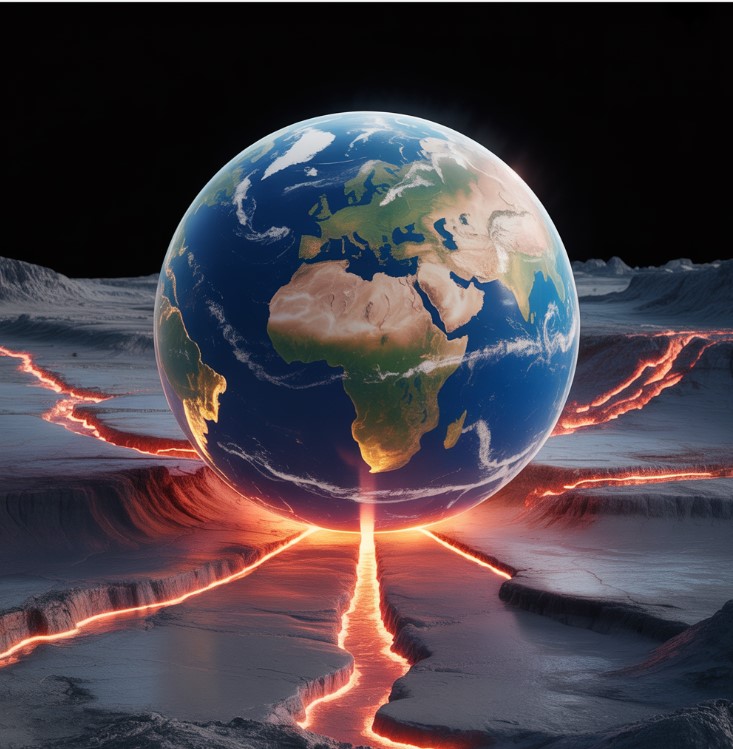
- Internal Energy: Originating from the radioactive decay within the Earth’s core and mantle, this energy manifests as tectonic activity (plate movements, mountain building, faulting) and volcanism. Internal energy creates the primary relief, the initial high and low areas on which external processes then operate.
B. Primary Geomorphic Processes (Mechanisms of Change):
These driving forces translate into a series of interconnected processes that continuously reshape the Earth:
- Weathering: This is the in-situ breakdown of rocks and minerals at or near the Earth’s surface.
- Mechanical/Physical Weathering: Involves the physical disintegration of rocks without chemical change. Examples include frost wedging (water freezing in cracks, expanding, and breaking rock), thermal expansion and contraction (due to temperature changes), and root wedging (plant roots growing into cracks).
- Chemical Weathering: Involves the alteration of rock-forming minerals into new minerals or dissolved ions through chemical reactions. Examples include dissolution (e.g., limestone dissolving in acidic rain to form karst landscapes), oxidation (e.g., rusting of iron-rich rocks), and hydrolysis (reaction of minerals with water).
- Erosion, Transport, and Deposition: These are sequential processes involving the detachment of weathered material (erosion), its movement from one place to another (transport), and its eventual settling in a new location (deposition).
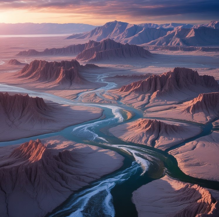
- Fluvial Processes: These are processes driven by flowing water in rivers and streams. Rivers erode their beds and banks, transport enormous quantities of sediment (from fine clay to large boulders), and deposit these sediments to form features like floodplains, deltas (e.g., the Nile Delta), and alluvial fans. They are primary architects of valleys and drainage basins.
- Glacial Processes: Driven by the movement of ice. Glaciers are incredibly powerful erosional agents, carving out distinctive U-shaped valleys, cirques (bowl-shaped depressions), and fjords. They transport vast amounts of rock and sediment, depositing them as moraines (ridges of till) and drumlins (elongated hills).
- Aeolian Processes: These involve the action of wind. Wind is particularly effective in arid and semi-arid regions, eroding surfaces through abrasion (sandblasting) and deflation (lifting and removal of loose particles). It transports sand and dust, creating features like sand dunes (e.g., the Sahara Desert’s erg landscapes) and loess deposits (wind-blown silt).
- Marine Processes: These are the actions of waves, tides, and ocean currents on coastlines and submarine features. Waves erode cliffs, create sea arches and stacks, and transport sediment along beaches, forming spits and barrier islands. Submarine currents also shape the seafloor.
- Mass Wasting/Hillslope Processes: These are gravity-driven movements of soil and rock down slopes. They range from slow, imperceptible creep (gradual downslope movement of soil) to rapid and destructive landslides (e.g., mudslides, rockfalls, slumps). Factors like water saturation, slope angle, and vegetation cover significantly influence these processes.
- Biological Processes: Living organisms also play a significant role. Plants contribute to soil formation, stabilize slopes with their roots, but can also cause bio-erosion (e.g., root wedging). Animals burrowing can loosen soil. Humans, as a dominant biological agent, exert immense influence, leading to a specific field known as anthropocene geomorphology (discussed later).
- Tectonic & Volcanic Processes: These internal processes create the large-scale framework of the landscape. Tectonic forces cause uplift (forming mountains and plateaus), subsidence (creating basins), folding, and faulting. Volcanic activity can build new landforms like volcanoes and lava plateaus, and distribute ash and pyroclastic material. Earthquakes, resulting from tectonic activity, can cause ground deformation and trigger landslides.
C. Interplay and Feedback Loops:
Crucially, these processes do not act in isolation. They interact in complex ways, forming intricate feedback loops. For example, tectonic uplift creates steep slopes, which accelerate mass wasting and fluvial erosion. Increased erosion, in turn, can reduce the load on the underlying crust, leading to further isostatic uplift. Climate change influences precipitation and temperature, affecting weathering rates, glacial extent, and river discharge, thereby altering the efficiency of various erosional and depositional processes. Understanding these interdependencies is key to comprehending landscape evolution.
A Journey Through Time: The Evolution of Geomorphic Thought
The understanding of how Earth’s surface changes has evolved significantly over centuries, moving from philosophical observations to quantitative, process-based science.
A. Early Observations & Antiquity:
Ancient civilizations made astute observations about landform change. Ancient Greek thinkers like Herodotus described the annual deposition of silt by the Nile River, recognizing the delta as a product of fluvial processes. Roman philosopher Seneca noted the presence of marine fossils in mountains, suggesting that land and sea levels must have changed over time. Similarly, early Chinese scholars documented river channel changes and soil erosion. While lacking a comprehensive theoretical framework, these early insights laid the groundwork for the idea of a dynamic Earth, challenging notions of a static, divinely created landscape.
B. The Birth of Modern Geomorphology (18th-19th Century):
The 18th century saw the emergence of uniformitarianism, championed by Scottish geologist James Hutton and later popularized by Charles Lyell. This principle, “the present is the key to the past,” posited that the same slow, continuous processes observed today have operated throughout geological time to shape the Earth. This contrasted with catastrophism, which attributed landforms to sudden, violent events. The term “geomorphology” itself gained prominence in the late 19th century. A pivotal figure was William Morris Davis, an American geographer, who proposed the influential “cycle of erosion” model. Davis described a landscape evolving through stages (youth, maturity, old age) driven by uplift and erosion. While highly influential for its systematic approach, Davis’s model was later criticized for its deterministic and oversimplified view, often overlooking the complexity of real-world processes and the role of climate.
C. Mid-20th Century Shifts:
The mid-20th century witnessed a significant shift from Davisian-style landscape evolution to “process geomorphology.” Researchers began to focus on directly measuring and quantifying the rates and mechanisms of geomorphic processes in the field and laboratory. This period also saw the rise of quantitative methods, incorporating mathematics, physics, and statistics into geomorphic research. Climatic geomorphology also gained traction, emphasizing the profound influence of different climatic zones on dominant geomorphic processes (e.g., glacial processes in cold regions, fluvial processes in humid regions, aeolian processes in arid regions).
D. Contemporary Perspectives:
Modern geomorphology emphasizes dynamic equilibrium, suggesting that landscapes often achieve a balance between forces of uplift and erosion, rather than strictly following a linear cycle. It acknowledges stochasticity, recognizing that random or infrequent events (like major floods or earthquakes) can have disproportionately large and lasting impacts on landscapes. The field now embraces complex systems theory, recognizing the non-linear interactions and feedback loops between processes. There is a strong emphasis on multi-causal explanations, understanding that most landforms are the product of multiple interacting processes over varying timescales. Crucially, contemporary geomorphology explicitly integrates human impacts, acknowledging humanity’s role as a significant geomorphic agent, leading to the concept of the Anthropocene.
Geomorphology in Action: Interacting with the Human World
Geomorphological knowledge is not merely academic; it has profound practical applications, directly influencing human safety, resource management, and environmental policy.
A. Geomorphic Hazards & Risk Assessment:
Understanding geomorphic processes is fundamental to identifying, predicting, and mitigating natural hazards. Geomorphologists assess risks posed by:
- Landslides: Identifying unstable slopes, understanding triggers (e.g., heavy rainfall, earthquakes), and mapping potential run-out paths help inform land-use planning and engineering solutions to prevent or manage slides.
- Floods: Studying river channel morphology, floodplain dynamics, and sediment transport helps predict flood extents and frequencies, crucial for urban planning and emergency response.
- Soil Erosion: Analyzing factors like slope, soil type, and vegetation cover helps predict and combat soil loss, which can degrade agricultural land and impact water quality.
- Ground Subsidence: Understanding processes like dissolution of underlying rock (karst), compaction of sediments, or withdrawal of groundwater helps identify areas prone to ground collapse or sinking.
- Coastal Erosion: Studying wave dynamics, sediment budgets, and sea-level rise helps assess the vulnerability of coastlines and inform strategies for coastal protection (e.g., beach nourishment, seawalls).
B. Land Use, Resource Management & Engineering Applications:
Geomorphological principles guide numerous aspects of land use and engineering:
- Urban Planning: Identifying stable ground for construction, avoiding floodplains, and understanding drainage patterns are critical for safe and sustainable urban development.
- Infrastructure Development: Designing roads, bridges, and pipelines requires knowledge of underlying geology, slope stability, and potential for erosion or subsidence.
- Agricultural Practices: Understanding soil characteristics, erosion susceptibility, and water runoff patterns informs sustainable farming methods, such as contour plowing and terracing.
- River Restoration: Geomorphologists provide expertise for restoring degraded river systems, designing stable channels, and enhancing ecological habitats by understanding natural fluvial processes.
- Coastal Protection: Designing effective coastal defenses, such as breakwaters or artificial dunes, relies on understanding wave energy, sediment transport, and long-term coastal evolution.
- Dam Construction: Assessing the geological stability of dam sites, predicting reservoir sedimentation rates, and managing downstream river changes are key geomorphic considerations.
- Mining Impacts: Understanding the geomorphic consequences of mining, such as altered landforms, increased erosion, and sediment pollution, is vital for reclamation and environmental management.
C. Human Impact as a Geomorphic Agent (Anthropocene Geomorphology):
Humans are no longer just passive observers of geomorphic processes; we are increasingly powerful geomorphic agents ourselves. This has given rise to the concept of Anthropocene Geomorphology, which studies how human activities directly or indirectly accelerate or alter natural geomorphic processes.
- Deforestation: Removes protective vegetation, significantly increasing rates of soil erosion and landslides.
- Urbanization: Involves massive earth-moving, sealing surfaces with impervious materials (e.g., concrete), altering natural drainage patterns, and often increasing flood risk downstream.
- Climate Change: Human-induced climate change alters temperature and precipitation patterns, leading to increased frequency and intensity of extreme weather events, accelerating coastal erosion, glacier melt, permafrost thaw, and changes in fluvial regimes.
- Land Reclamation: Creating new land from oceans or wetlands fundamentally alters natural coastal and aquatic processes.
- Dam Construction: Traps sediment, alters downstream flow regimes, impacts river morphology, and can cause ground subsidence due to reservoir loading.
- Mining and Quarrying: Directly excavates and reshapes large areas of the Earth’s surface, creating new landforms (e.g., spoil heaps, open pits) and releasing sediments.
The Geomorphologist’s Toolkit & Interdisciplinary Connections
Modern geomorphology employs a diverse set of tools and thrives on collaborations with other scientific disciplines.
A. Modern Methodologies:
Geomorphologists use a combination of traditional and cutting-edge techniques:
- Field Observation: Direct observation, mapping, and measurement of landforms and processes in their natural settings remain fundamental.
- Remote Sensing: This rapidly evolving field provides invaluable data.
- GIS (Geographic Information Systems): Software used for analyzing, managing, and visualizing spatial data, allowing for complex mapping and overlaying of different geomorphic information layers.
- Lidar (Light Detection and Ranging): Creates highly detailed 3D models of the Earth’s surface, revealing subtle topographic features and changes.
- Satellite Imagery: Provides broad-scale, repetitive coverage, allowing for monitoring of large areas over time for changes in landforms, vegetation, and water bodies.
- Laboratory Analysis: Analyzing sediment samples (e.g., grain size, mineralogy), water samples (e.g., dissolved solids, chemical composition), and rock samples provides insights into weathering rates, transport processes, and material properties.
- Geochronology: Techniques like radiometric dating (e.g., carbon-14, luminescence dating) determine the age of sediments, landforms, and past geomorphic events, establishing rates of change over geological timescales.
- Numerical Modeling and Simulation: Computer models simulate geomorphic processes, allowing scientists to test hypotheses, predict future landscape evolution under different scenarios (e.g., climate change), and understand complex interactions.
B. Disciplinary Overlaps:
Geomorphology is inherently interdisciplinary, drawing from and contributing to numerous fields:
- Geology: Provides the foundational understanding of rock types, structural geology, and tectonic processes that create initial relief.
- Physical Geography: Closely allied, physical geography examines the spatial distribution of natural phenomena, including landforms, climate, and ecosystems.
- Hydrology: The study of water movement on and beneath the Earth’s surface is crucial for understanding fluvial, glacial, and hillslope processes.
- Soil Science: Understanding soil formation (pedogenesis) and properties is vital for studying weathering, erosion, and agricultural applications.
- Ecology: Landforms create diverse habitats, and ecosystems in turn influence geomorphic processes (e.g., vegetation protecting against erosion).
- Civil Engineering: Applies geomorphic knowledge for site selection, construction design, and hazard mitigation in infrastructure projects.
- Climatology: Climate dictates the dominant geomorphic processes in a region, and understanding past and future climate changes is critical for geomorphic predictions.
- Archaeology: Landform evolution affects the preservation and discovery of archaeological sites, and geomorphologists help reconstruct past landscapes that early human societies inhabited.
C. Beyond Earth: Planetary Geomorphology:
The principles of geomorphology extend beyond our home planet. Planetary geomorphology applies these concepts to understand landforms on other celestial bodies. For instance, studies of Mars reveal evidence of ancient fluvial activity (river channels), glacial processes (polar ice caps, valley glaciers), and extensive aeolian sculpting (dune fields). Understanding Venus’s volcanic plains, Titan’s methane rivers and lakes, or the impact craters on the Moon all rely on geomorphic interpretation, highlighting the universal nature of many physical processes that shape planetary surfaces.
Conclusion: A Continually Evolving Landscape
A. Synthesis:
Geomorphology reveals Earth’s surface as a perpetually dynamic system, where internal forces create the grand canvas and external forces relentlessly sculpt its intricate details. It is a field that seamlessly integrates geology, climate, water, and life to explain the diverse array of landforms we observe. By understanding the fundamental processes of weathering, erosion, transport, deposition, and the interplay of forces like gravity and tectonics, we gain a profound appreciation for the ever-changing nature of our planet’s skin.
B. Future Challenges:
In the coming decades, the importance of geomorphic understanding will only intensify. With rapidly accelerating climate change, increasing global population, and mounting pressure on environmental resources, geomorphologists play a critical role. They are at the forefront of predicting the impacts of sea-level rise on coastlines, assessing the risks of more frequent extreme weather events (e.g., floods, landslides), and developing sustainable land management strategies to mitigate soil degradation and water scarcity. The human footprint on Earth’s surface is growing, making Anthropocene Geomorphology an increasingly vital area of study.
C. Ongoing Research:
Geomorphology remains an active and evolving field. Researchers continue to refine numerical models, leverage cutting-edge remote sensing technologies, and conduct interdisciplinary studies to unravel the complexities of landscape evolution. From understanding the nuances of critical zone processes (the interface where rock, water, air, and life interact) to exploring the potential for terraforming other planets, geomorphology offers a rich and essential domain of scientific inquiry. It is a testament to the enduring fascination with our planet’s beautiful, powerful, and ever-changing surface.


